Here we met son Peter with his Alexandra, coming from Bangkok on their one and a half year tour around the world.
The plan was to visit national parks, and then travel to Reno, Nevada for a snowboard experience.
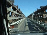
 We collected the rental car, a luxurious full size eight cylinder Dodge Inteprid.
We drove for hours and were still in the outskirts of Los Angeles. At last we discovered in the desert a motel. Next morning we traveled to Death Valley. Interesting, as it is the lowest point on the western hemisphere and the hottest recorded place on earth.
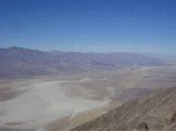
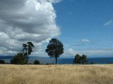
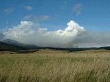
Upon approaching Death Valley we decided to enjoy the outlook over the valley from a 1500m high hill.
We collected the rental car, a luxurious full size eight cylinder Dodge Inteprid.
We drove for hours and were still in the outskirts of Los Angeles. At last we discovered in the desert a motel. Next morning we traveled to Death Valley. Interesting, as it is the lowest point on the western hemisphere and the hottest recorded place on earth.
Upon approaching Death Valley we decided to enjoy the outlook over the valley from a 1500m high hill.
It was February, but it was already hot. In Dead Valley there was a kind of oasis with green trees. A stunning landscape of wastelands and dunes.
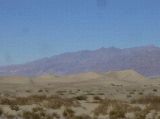
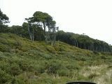
Upon leaving Death Valley on the hills there were many trees, with leaves like a yucca. The leaves were sharp as needles.
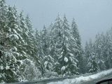
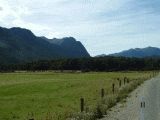
 The next destination was Sequoia National Park. It was close to Death Valley, to the west, separated by a mountain ridge. However the Death Valley is a desert and the Sequoia national Park lies high in the mountain, more than 1800m, partly deep in snow, in a winter wonderland!
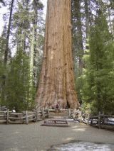
The sequoia trees are big and this is the biggest tree in the world measured in cubic meters, 1450 cubic meters. There are, however taller and thicker trees. About these later. The trees are like huge pillars in a candle shape, so thick as the top as well
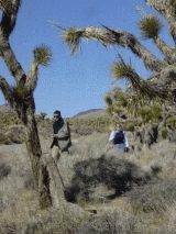
The trees only can survive and seeds can sprout if an occasional fire occurs. In the last one hundred years a huge effort was made to prevent fire. So the combustible material was piled up and if, by lightning, a natural fire started, it was so intense that it killed every tree. So the last hundred years no new trees sprouted. After a policy of controlled fires, many young trees emerged.
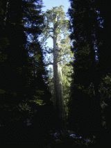 There are many hundred sequoias and the reason they are still there, is that the quality of the wood is that bad that it had no value for woodcutters. They need a cool, wet climate on these mountains.
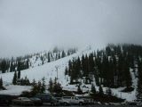
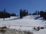 The next destination was Yosemite National park. Some people who have been there told me that if paradise was on earth, it should be here. On the way we made a detour to Badger Pass, to check out the snow, which was abundant.
A paramedic there advised me to go right the way to a doctor, as my little finger was badly inflamed after a cut, and became worse every hour.
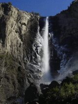 Yosemite National park is indeed beautiful. Soon we arrived at the Bridal Veil Falls. Car size chunks of ice fell down with a thundering noise. Impressive!
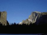 Yosemite is a deep valley between sharp, steep rocks. In the evening light the light near the famous Captain Rock is beautiful.
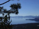 Then we left to the west and descended to fertile valleys, with lots of orange trees. We bought a big sac of the finest oranges we ever tasted: the Washington navels. Through the old goldfields of California we traveled to the pretty Lake Tahoe, 1900m high and surrounded by ski resorts. That was one of the reasons to come here.
Our destination was Nevada.
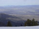 We had booked rooms in Atlantis, a huge gamble hotel in Reno. The first floor is covered with thousands of gambling machines, which operated day and night. Though it was the low season just prior Presidents Day, there were many gamblers. Of course we did not gamble a cent, but just took advantage of that hotel so close to the skiing area’s. Reno lies in the desert but on the mountain, the base is 2400m, is excellent snow. We enjoyed Mount Rose and went to Squaw Valley. Excessive lift tickets of $58 spoiled the fun a little.
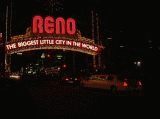 Reno is a desert town, the primary industry is gambling. The town is brightly lighted by neon and there are countless gamble palaces. We visited a few not for gambling of course but to enjoy luxurious buffets for a very reasonable price. In one was a replica of a silver mine. The average gambler was not showing too much happiness. The scarcely dressed girls offering free drinks to the gamblers were the most exiting element.
 We had a wonderful time together. After a week we left the kids, they kept on snowboarding while we were planning to travel some more thousands of miles to see the highlights of California. We left Reno to the north through the desert. We stayed east from the famous Sierra Mountains.
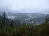
We moved then to the west and drove through the nice Indian Valley where the Last Chance river was, and ended up Lassen Vulcanic National Park. We approached the park through meters high walls of snow. We skipped the visit there as the park did not seem to be cleared from snow.
This is the first picture we could recover. What happened? The first 110 pictures (made until now) were in later in New Zealand copied on CD ROM and memory stick. However, at home they could not be found back, so they are probably somewhere on the hard disk of that computer. The pictures before were made by Peter. Thank you Peter. For more and better pictures visit his website on his trip around the world www.wereldreis.nu
While we were traveling we saw at the horizon a high and white isolated cone of a volcano. We looked in our guide, the Lonely Planet and as there was a ski area, we decided to check out the Mount Shasta.
While we came closer the volcano became more and more impressive, glittering in the evening sun, so we were looking forward for a nice day skiing and snowboarding.
In the night however it started raining and next morning the ski lifts were disappearing in the clouds, so we skipped that plan. We went again to the west to the coast.
Through road 299, a “scenic” route we drove to Eureka, via Whisky lake. The Trinity river offered a breathtaking view, every mile. It is still raining and sometimes we climb in the cloud, but we enjoy every minute. The 299 took us for 146 mile to the California Redwoods National Park.
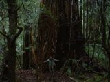 Redwoods are the tallest trees on earth, and well protected. Only 50 cars a day are allowed in the park and from the Tall Trees Grove, where the giants are, it is still a strenuous walk down, and later up. Many visitors do not take that effort, so few people see the giants. The California redwoods (sequoia sempervirens) is he only conifer in the world which can multiply itself by sprouting out of the roots. So an old tree is surrounded by his offspring and often you see a circle of giants while the ancestor is already dead. The trees can live 1000-2000 years. To be more accurate, the dead center of the tree is that old, but the living substance under the bark is never more than 30 years old.
After a long walk we at last discovered the highest tree on earth, 112m high. Very impressive. The forest was shrouded in ferns and Spanish moss, what hung like shabby curtains from the branches.
 We had to speed up as it was becoming dark. On the way out we could see the grove with the giants. Now we have seen the thickest tree (in Oaxaca, Mexico) the biggest tree, the sequoia and the tallest tree, the California Redwood.
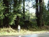 While driving to the south, we heard that the main road 101 was blocked by a landslide and we have to go back. In stead of the 299 we take a small road, the 36. The road leads us through strange named villages like Madville, Peanut and Platina. We come in redwood country again and here we see that the forest is cut. However, the young sprouts are growing again. Birgitt stands for a huge cut tree, surrounded by young ones. Only 300 years waiting and you hardly will notice the damage caused by greedy woodcutters.
 It is raining again and the road is climbing. Suddenly the rain turns in snow, lots of snow. Not so nice without snow chains, but we survive. Then the cloud breaks we are again in a winter wonderland. We enjoy our trip quite a lot. A wonderful trip, the road 36 from Fortuna till Red Bluff.
 We are descending to the Sacramento Valley, and the hills are covered with walnut trees.
The road is here following the surface of the hills, just like a roller coaster. Nice
Highway 5 to Sacramento goes through a flat valley, with both sides mountains. It looks very fertile. We see lots of rice fields and almonds.
We are descending to the Sacramento Valley, and the hills are covered with walnut trees.
The road is here following the surface of the hills, just like a roller coaster. Nice
Highway 5 to Sacramento goes through a flat valley, with both sides mountains. It looks very fertile. We see lots of rice fields and almonds.
We decided to take the 156 to Monterey, were the famous Big Sur starts. It is the road along the coast and labeled one of the major tourist attractions of the USA. Indeed it is beautiful. The ocean is deep blue the waves are white crested. Though it is winter you smell the flowers and herbs.
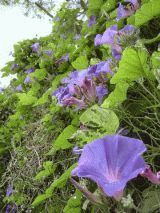
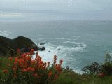 Everywhere you see the red flowers, which look like the Indian paintbrush from Texas.
With the waves on the background it offers a nice sight.
Everywhere you see the red flowers, which look like the Indian paintbrush from Texas.
With the waves on the background it offers a nice sight.
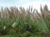
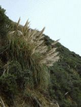 Every where you see a kind of huge grass. It looks like the “pampas grass” often planted in gardens.
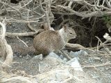 During a stop we see a ground squirrel. The animal looks intelligent and cute.
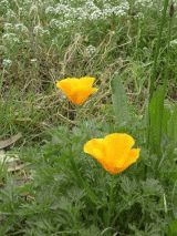 Much to our surprise we see the California Poppy, which we grow with success in our Hungarian garden. It is there named Kalifornia Mák.
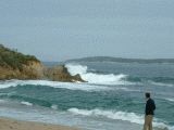
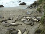 It is the time of the year that whales migrate from the south, Baja California, to the north. We keep a sharp lookout but we have no luck. Later this trip we will see some very close! We pass along a colony of elephant seals, the biggest kind of seals. The aggressive males are fighting and have lots of scars. We are lucky: the young are still on the beach and will soon leave. We continue the coastal road and like to stop on every bend of the road to enjoy the scenery, but we have to go on as tomorrow our plane leave for the Fiji islands. This day was a nice birthday celebration for Birgitt. I love you, my dear!
 We travel through an interesting landscape in the direction of Los Angeles. We see Vandenberg Air Force Base and NASA space center, but we see no missile launch. We sleep in Hollywood and get a parking fine while in the post office to send back our wintersport equipment and the many thing we purchased. We wash our car but when dropping of the shiny car we see that anybody else delivers the car dirty. So a waste of time and money.
Bur we are very satisfied by the Dodge. More than 6500 kilometers without any problem. And no scratch and that is OK as I never take the extra insurance.
We travel through an interesting landscape in the direction of Los Angeles. We see Vandenberg Air Force Base and NASA space center, but we see no missile launch. We sleep in Hollywood and get a parking fine while in the post office to send back our wintersport equipment and the many thing we purchased. We wash our car but when dropping of the shiny car we see that anybody else delivers the car dirty. So a waste of time and money.
Bur we are very satisfied by the Dodge. More than 6500 kilometers without any problem. And no scratch and that is OK as I never take the extra insurance.
 The departure at Los Angeles was not without problems. The security insisted Birgitt had a corkscrew in her hand luggage. But we had no. The luggage was checked over and over again, but they couldn’t find it, while it showed on the röntgen. It appeared that Birgitt had my long ago “lost” pocketknife, razor sharp. We had to speed back to put it in our backpacks, luckily we were not too late.
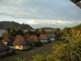
We boarded the plane on the 18th and were scheduled to land the 20th as we crossed the date line. The 19th was gone. What would have happened if Birgit had her birthday in the 19th in stead of the 17th? Then she would not have a birthday and so stay a year younger! We landed according schedule on 02.00 in the night and had nothing arranged. It was hot and moist, with that typical smell of the tropics. A lady tried to convince us she had a nice program for us and we booked a trip to the volcanic island on the west coast, a motel at the Coral coast, the south of main Fiji island and a hotel the last night. A few hours later we boarded the trimaran to Waylaylai resort. The boat passed several islands to drop off and collect passengers. We had to leave the boat a few kilometers from the coast and were transported by a small fast boat. It was stormy weather. There were huge waves and we were showered by the seawater, but reached the coral coast safely.
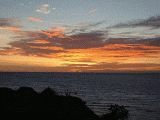
The resort was located on the coast and operated by locals. It was full and we were lucky to get a cabin. We booked for a sunrise climb op the volcano, but the guide knocked on the wrong door at 04.00 (they surely were not too happy with that!) so we decided to see the sunrise from the terrace. Seldom we’ve seen such stunning colors at sunrise. In the background you can see the main island at the horizon.
 The resort was isolated on the island and everything was shipped in. There were 3 meals a day and a afternoon tea. The events were announced by the blowing of a shell horn. The meals were delicious and we were really looking forward to it. We booked a trip to a nearby village. It was nice situated around a big grass area. We were invited to the sacred kava ceremony. Kava is a kind of drug, very popular in Fiji. It are roots, dried and made to powder, mixed with water. You can compare it with potato peels with water mashed in the food processor. So it tastes. You have to say Bula, clap your hands in a certain sequence and drink the stuff. I wouldn’t say it’s harmless, as I got soon after a strange tricklish feeling in the skin which came intermittent back for months.
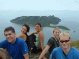 Next day we climbed the mountain with a group of friends. It was hot and moist and Suzy was running uphill! We, Nolan and Kathy did it at a normal pace. The climb was magnificent and so was the view. We loitered some time up there to enjoy the scenery. Next day snorkeling. It was OK but not the stunning colored coral we saw at the great Barrier Reef in Australia.
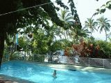 It was time to move to the next location and the boat ferried us back. Too late for the bus! Somebody stopped a van and the driver was so friendly to transport us to our hotel, 60 kms away. It was a nice surprise: a big room at the poolside.
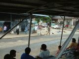
We spend the time there running in the morning, relaxing and walking. We walked to Sigatoaga at noon, only 8 kms, but in the tropics it’s rather heavy. We got many offers for a lift, but we insisted to walk. Sigatoaga looks like any other tropical third world town, worn down and not smelling too good. We visited the market and as there were no tourists, we bought some stuff from Indian saleswomen to support them, of course too expensive. There were nice necklaces of local mined hematite and many other nice “jewelry”
 After a few days we had to catch the plane to New Zealand. We went by open bus back to Nadi (They pronounce it as Nandi) to the hotel and spend the evening with a farewell dinner.
It is a rather strange country: The Fijians are a Negroid type of people, by tradition keen on cannibalism. Only 150 years ago it was colonized by the English, who imported laborers from India. They form now the majority of the people. A few years ago was a revolt, in which the Fijians took control with a rather racist legislation.
It is another world with other rules. Don’t go without guide walking in the hills, as you may encounter taboo things without knowing it, and you may regret you ever were here.
No surprise the tourists are almost gone. Another nasty thing happened. The complete world tour until now was typed in the Nokia communicator which stopped operating here. In 3 countries no one could repair it or retrieve the data, so it took some effort to start again all over. That’s why the website is published so long after the trip.
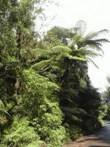 The flight to New Zealand was uneventful. We followed the advise of the Lonely planet to declare everything. A girl we later met was fined on the spot 300$ as she forgot to declare an orange in her hand luggage. It was windy in Auckland and smack on time we collected the camper. After shopping right the way to the north. Soon we saw the first fern trees. They may be 20 meters high.
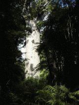 Our plan was to make a big 8 on the Northern Island north of Auckland. Then pass Auckland again (we avoid big cities usually) to the south. In the north are still some Kauri trees. It is a big conifer with excellent wood, so 96% is cut and lost forever. The last big tree is the Father of the Forest (Te Matua Ngahere in Maori language), a stunning big pillar of wood, 4000 years old. Few remain from the original vegetation. In New Zealand humans are only 1000 years, the last 2 centuries the white colonist as well. But in 1000 year of dedicated destroying effort, most of the original nature is gone. Why is new Zealand so special? It formed 200 million years ago one super continent called Pangea with South America, Africa, Australia, India and Antarctica.. New Zealand drifted away and through its isolation and relatively small size, it retained many of the original species, which were lost due to climate changes and competition of other species. The tuatara for instance is an independent kind of animal , unchanged for 350 million years and vaguely similar to a lizard, only living here.
 Through a lovely green landscape of green rolling hills we reached Opnoni on the west the coast. En route we visited the Kauri Museum. We learned here that out the moors 30.000 years old trunks were recovered. They can be worked till fine pieces of art. Out the same moors the resin was mined, similar to amber, but not that old. The resin was worked into beautiful objects and used for the industry making lacquer.
Opnoni lies at the Tasman sea and had enormous and nice sand dunes.
 We continued the last day of February our “8” in the north and see the sad results of deforestation We drive from Kaikoke to Maungatapoere. You see that usually the Maori words are used for towns and rivers. This leaves us without any reference, just a diarrhea of letters.
Delicious were the wild peaches along the road. Everywhere you see these nice red flowers.
 Even the weeds are nice. Often you can see here blue walls of climbing flowers. We sleep this night in a camping associated wit a thermal pool. We enjoy the warm water pools and the waterslides. The small one is used often, the big one not. So we try the last. It was a very spectacular ride. However the segments are not properly connected and we get bruises al over, some still visible after a half year.. But once in the big slide was really enough.
 En route to the south we see everywhere that high pampas grass. Rarely we see a reddish variety, even higher.
 We travel further to the south, passing Auckland again and see in the distant horizon something white on the mountains. Is this a waterfall? No indication on the maps or the tourist information. Through a long detour we manage to find the waterfall. We see a small sign Wairera Falls. We try to climb the mountain through a fairytale forest, but halfway the path is blocked. We then climb on a very steep, slippery clay surface up, surviving only by clinging from tree to shrub. But it is too dangerous. Why risking your health this way?, so Birgitt returns. In the forest we see how enormous the fern tree leaf can be.
In New Zealand everything is indicated and listed what should be of interest for tourists. Every guide has the same items. Nice path walks lead you from parking places to the point of interest. Continuously you see allover the week the same persons as there are few other roads. You do not have the feeling you are a real explorer discovering new things, more of “tourist cattle” guided along points of interest. You don’t get the feeling you are a “Livingstone” . This waterfall however had a little of the feeling that you saw something others did not see.
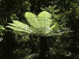
 The fern trees have huge leaves.
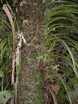 If you look close to a tree you see a very complex symbioses of very different kind of plants and animals, apparently depending on each other.
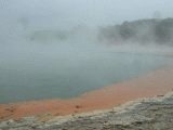 This hot lake in the Rotorua volcanic area, Wai-o-Tapu, is bubbling like champagne and is loaded with minerals, including gold. A strange atmosphere is here, as the lake is shrouded in clouds.
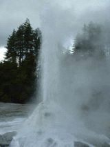 Then we have to hurry for the eruption of the geyser Lady Knox. All over the world there are only 450 geysers. They need water, the mineral rhyolite and geothermic heath. It works as follows. Rhyolite forms cracks which are partly sealed by this rhyolite, so a “plumbing” of cracks and channels forms in the ground. If water is filling the cracks, it is heated up. Depending on the depth it may reach temperatures far over 100 degrees C. If somewhere the water starts boiling the volume increases and water starts streaming out of the opening. The result is that the volume of water is less, so the pressure down there becomes less. The super heated water start boiling then, pushing in a kind of explosion the water out of the geyser. The plumbing is now empty, will be filled up again with water, heated and the show can repeat itself.
For reasons not known the reaction can be triggered by letting soap sink in the water. So a person dropped a kilo soap in the geyser and minutes later the show starts.
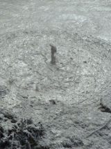 Then we visit a big lake with boiling mud. At lots of places in the mud lake the mud is boiling and the bubbles cause strange effects. When you leave there you are speckled with mud particles.
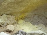 At some places the hissing steam let sulfur vapor sublimate to bright yellow structures.
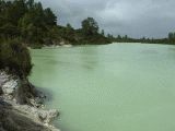 At the end of the area was a turquoise colored lake, of course dead as no organism can survive the chemical substances coming from deep.
 New Zealand is one of the very few countries able to exploit geothermic energy. Just tab off the heat in the ground and transform it to electricity. Is it that simple? Yes, the heat is transformed to electricity. And how do you get that heat? We saw a huge pipeline system set up in the “steam fields” which transported the steam to the power station. It looked difficult to maintain as the steam must be very corrosive. And the power station had an output of only 108 megawatts. So, fans for renewable energy, this is not the ultimate solution for the electricity requirements of the world.
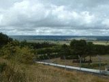
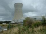 The power station itself is rather small with a huge cooling tower. It is for 20 years in operation.
 Further to the south we arrive at Lake Taupo. Clear blue water, at the coast we see volcanic foam stone which floats in the water. Lake Taupo was formed 2000 years ago in a big eruption. The effects were noted in China and Rome. However, 30.000 years ago one of the biggest eruptions on earth occurred here, in which 800 cubic kilometer ground was launched in the air., which covered most of New Zealand. We travel further to the south, to Tangariro National Park, with 3 volcano’s, these were the décor in the lord of the Rings movies. We like to climb the Mount Ruapehu with a guide but when we wake up next morning it is raining, and no visibility.
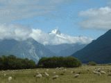
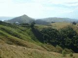
 We plan to go to another volcano, the Mount Plymouth. The road leads through a nice green rolling landscape with stunning views. Lot of sheep and deer can be seen. We make a map analysis and try the “Forgotten World trail”, and then the State Highway 40. But surprise, no road but a dirt track! We are lucky. No people and almost intact jungle. We enjoy every meter of the track, at last unspoiled nature without tourists! We try to penetrate in the dense jungle, but every inch cost a lot of effort. So must New Zealand have looked prior human influence. Here we feel a little like explorers, in stead of tourist following the brown tourist signs.
We arrive at the west coast and see a big industrial complex. It is the Motunui Synthetic Fuel Plant. However, they make there methanol out of natural gas from the Maui field. In fact one of the biggest methanol producers in the world. We let us inform about the production facilities and the technology. Surely interesting.
 We sleep at a stormy west coast, Tasman sea. In Oakura. The sand is black, but you are not at all getting dirty from it. We make long evening walks over the black sand.. And in the morning, like every morning we make our run to keep our condition. Nice waves, a surf Walhalla.
We visit the Maui gas production processing plants, one time one of the biggest gas fields in the world. It was 300 billion cubic meters big. Later a second field next to the old one was discovered, which produced 1.3 million ton crude oil as well. It is stored on a floating tanker. The end of productions looms, however. The technology used is from Shell, Holland.
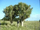 Everywhere you see the cabbage trees. Nothing to do with cabbage, but a kind of yucca.
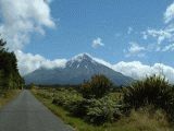 We drive inland again and see many domes of basalt, like a volcano that started but stopped when it was 20 meters high. The main destination today is the mount Egmont or Mount Taranaki. The volcano is 2512m high, partly covered in snow. The volcano is isolated, symmetrical and many people like to climb it. However, the mountain is very treacherous. About 67 people died in the last years, usually caught in rapidly changing weather. The storms can approach very quickly in these area’s. We mount the mountain as far as we can go and enjoy a nice view.
We proceed further to the south and sleep in Levia, in sight of the Tararua Mountain range.
We have booked the ferry to the South Island the next day and now we have to speed up a little. However the main road is dull and we decide to take a detour through Upper Hut. A road full of bends and one car wide, so you have to drive carefully for opposite traffic. We enjoy the scenic route and find some time to spend in the capital Wellington, especially in the national TePa museum. Free entry, but parking cost a fortune. It is extremely interesting, but time is running out. We are on time to board the Inter Islander ferry for the three and a half hour trip to the South Island.
 We leave to the east and the landscape is barren, in desert colors . This you do not expect in green New Zealand. The area here is in the rain shadow of the central alps and very dry.
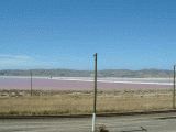 We even see a sea salt factory The big ponds have different colors according to the salt content, and ends in a kind of light purple. This is caused by micro organisms. We see the last phase of the process, where the salt is collected in hills, for further packing. The trip along the east coast is wonderful: the turquoise of the South pacific ocean merging to cobalt blue and deep blue. All covered by a bright blue sky.
 Our destination is Kaikoura, for whale watching. Near Kaikoura is a deep canyon in the seafloor with an undersea waterfall and a vertical wall of 600 meters. Currents from the deep supply nutrients for a rich sea life.
We are surprised about the ticket for more than 200 dollar, but no place and the lady is so friendly to put us on the waiting list. They expect heavy wind next morning and there is a good chance that people with a weak stomach will chicken out. So we are there next morning in pitch dark and wait patiently. Then a Hurrah! and a couple higher on the waiting list gets the tickets. We wait further and just before the deadline we get our tickets. You let yourself gladly rip off for 220 dollar! The boat is modern and on sea we see strange clouds. Kaikoura is famous for the sperm whales and we are lucky! We see a few. One is a huge one of 48 tons. He can dive for two hours and up to 3500 meter deep to catch its favorite food, the mysterious giant squid. It may measure up to 23 meters. The squids are swallowed as a whole. In the stomach of dead sperm whales loads of giant squid beaks can be found. Here they dive 600 meter deep for half an hour. Then they relax 10 minutes for a next dive.
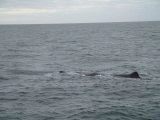 The whale is huge and blowing clouds of damp. He stays there for some minutes. This are males who stay there for a while, while the females with their young calf are somewhere else. Later in the season they meet again.
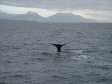 Then the giant dives. The back contracts, mighty tail comes up slowly and without any splash the whale starts its dive It is a stunning view, well worth the 220 dollars. We see the spectacle over and over again with different whales. Successful mission!
 On the way back we see the rare Dusky Dolphins. They are very curious and playful. One dolphin thinks it’s funny by repeatedly jumping out of the water and splashing on it’s side. It’s like a circus.
Still enjoying the magnificent spectacle we visit a resting place for fur seals but they are out.
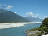
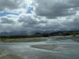 From Kaikoura we cross the South Island to the west. We pass nice valleys and impressive views. Here is the Waiau river in a wide riverbed. The mountains become higher and we pass the Lewis pass at 907 meters. The western side of the mountains becomes green with mountain tops high over the tree line.
What quickly passes the time. Now we have carefully to plan the rest of the trip to see the highlights. During our morning run in Reefton we see in the village a coal mine, and the manager shows us around. The coal is transported in a pipe, with water pressure. The production is 120.000 tons per year with a few employees and the production is shipped right the way, so no heaps of coal and waste. We travel to Greymouth, one of the bigger towns on the west coast. We are in a coal and gold area. From Greymouth we travel to Hokitika, where just that day is the famous Wild Food festival. It looks like few food and lots of booze. We arrive in the second half of the afternoon and the average guest has already a low blood level in his alcohol, so it’s time to leave quickly again.
 In New Zealand you see many narrow bridges on wide roads. Here it’s even worse. A one lane bridge combined with a busy railroad, without any traffic lights. And this is the only north-south road west of the alps! This shows how sparsely populated the South Island is.
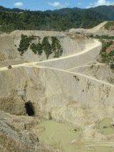 We are in Gold country and it’s time to test our luck. In Ross is the deepest open goldmine on earth.
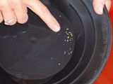 We try panning and Birgitt is quickly an expert: she finds gold! That tastes to more. We get permission to go to the riverbed in the concession and start digging right the way. It’s heavy: almost 10 kg of stones sand and water which should be moved in circles in a particular way to separate the gold from the dirt. It is hard labor and the result is nothing. We do it over and over again and without result. This leads to nothing. So we start using our brain in stead of muscles. We walk up the stream and try to evaluate where the alluvial gold must have been deposited by the stream. We examining many places and at last we see a bend in the stream in which the gold must have been set. We remove the top layer and scoop the sand. Surprise! Gold!! Lots of gold. We see very small particles glittering in the sun. Enthusiastically we try to pan the gold. But the gold dust is that fine that we cannot separate it from the dirt. We just lack the skills. But we know where to find the gold!
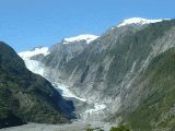 The Franz Jozef Glacier is the next target. On no place on earth glaciers descend lower on these latitudes. The reason is just that it rains here 700 cm a year, 10 times as much in rainy Holland. The deposits of snow high on the mountains are that huge that the glacier descends to 300 meter above sea level. We want to climb the glacier and climb over fences with “no entry”, “danger” and “very dangerous”. After the “extremely dangerous” sign we approach the glacier. The tongue is covered with gravel and rocks.
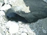 Everywhere we can see channels and cracks in the deep blue ice. It is risky to walk there. The ice can crack and if you fall in there it is doubtful id rescuers can get you out in time.
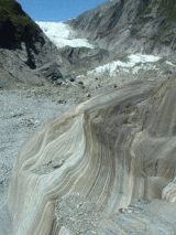 It is nice to see how the glacier churns out the rocks till the surface is smooth. A century ago the glacier almost reached the sea.
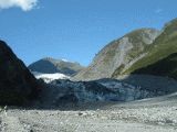 The next glacier is the Fox glacier. Impressive as well and better accessible.
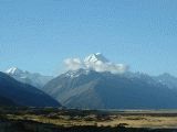
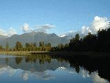 At the end of the afternoon we go to Lake Matheson. If you see a picture from New Zealand it’s a good chance it’s taken here. And in deed. We make loads of pictures of this nice lake, with the highest mountain of New Zealand, the Mount Cook in the background. Around the lake is a protected rainforest and an incredible variety of plants can be observed here.
Next morning we will see the sunrise here. But we arrive in the dark and unfortunately dense clouds and mist prevent nice pictures.
At the end of the afternoon we go to Lake Matheson. If you see a picture from New Zealand it’s a good chance it’s taken here. And in deed. We make loads of pictures of this nice lake, with the highest mountain of New Zealand, the Mount Cook in the background. Around the lake is a protected rainforest and an incredible variety of plants can be observed here.
Next morning we will see the sunrise here. But we arrive in the dark and unfortunately dense clouds and mist prevent nice pictures.
 We are early en route and further driving to the south we pass along dense shrubs which are nested in each other, so protecting each other from the wind. It looks like a hill but the ground is just flat.
 We drive to the end of a peninsula, Jackson Bay, to eat lobster. But the lobster joint was closed, so back to Haast. Over the Arawata river we take a nice picture. In Haast we get a well deserved Fish and Chips in stead of the lobster.
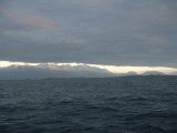
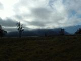 Further south of Haast we noticed an interesting play of light, shadow mountains and clouds. Every second the picture changes. We leave the car to enjoy it.
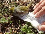 The disaster strikes. At least for a poor Rock wren. He hits the car and in the mirror we can see the poor bird on the road. As soon as we can we turn the car and speed back, seeing other cars riding over the poor birdie. Birgitt jumps out the car and picks up the Rock wren. It still lives, but shocked by the hit. We carefully move the bird to the side of the road and make a little open tent of big leaves so it can recover from the shock. Hopefully the Rock wren is now healthy flying around, telling stories to his friends about the miracle.
 The Mount Aspiring is 3027m high pyramid. Around it is a national park. Along the Lake Hawea we travel to Wanaka, where we check our email in an internet café. The connection is fast and the computers modern. As two of our digital camera chips are full, we copy it to our memory stick and burn them on a CD-ROM . We check if the pictures are on the memory stick and the CD-ROM, then we delete the pictures. It worked good for the big chip but the pictures on the smaller chip are NOT on the memory stick or the CD ROM. Probably somewhere on the hard disk of the computer of the internet café. Next year we will download them again.
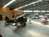 Not far from Wanaka is the Fighter pilots Museum. Interesting for a fighter pilot.
I talk about fighters and so with the management. Then the conversation gets an interesting turn. There are a few enthusiasts, who bought a Czech L-39 training jet. They do not dare to fly with it, and just taxi once in a while over the field. The question is if, I, as a former fighter pilot, am interesting to help them getting airborne. No I’m not.
The museum had very interesting Russian vintage fighter, the Polikarpov I-63. It flew among others in the Spanish civil war and the Second World War
Not far from Wanaka is the Fighter pilots Museum. Interesting for a fighter pilot.
I talk about fighters and so with the management. Then the conversation gets an interesting turn. There are a few enthusiasts, who bought a Czech L-39 training jet. They do not dare to fly with it, and just taxi once in a while over the field. The question is if, I, as a former fighter pilot, am interesting to help them getting airborne. No I’m not.
The museum had very interesting Russian vintage fighter, the Polikarpov I-63. It flew among others in the Spanish civil war and the Second World War
We travel from Wanaka to Queenstown through valleys churned out by ancient glaciers. Later through the Golden Hills. We see big herds of domesticated deer. We are en route to one of the highlights of the tour, the Milford Sound. This is a kind of fjord, but a special one. The closest overnight facilities are in Te Anau, at 60 kms.
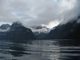 We travel in the dark to Milford Sound to get a tour around noon. We are early and there is a boat about to leave, we run and just get on board in time. The almost 2 hour cruise shows a stunning scenery.
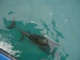
 We see on the rock sea lions. These are the young males, waiting until they are strong enough to compete with the males having a group of females.
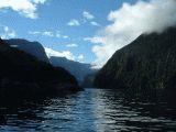 Every minute you see a different sight. The reflection of the sky and clouds, the mountains in the water is stunning.
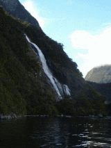 There are some waterfalls. If it is stormy weather the water is blown away prior reaching the water level. This time it was not windy.
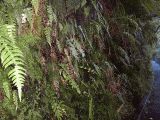 Under the waterfall was a very complicated symbiosis of plants and animals. However there were so many sandfies that you couldn’t stand still.
Sandflies are abundant in New Zealand. They are slow and small like gnats and they bite. They are very aggressive and their bite irritates for 2 weeks. And they are all day active. The drugstores do good business in repellent, which does not help, and lotion against the stings, which help. The sandfies are really pest which spoiled lot of the fun here.
Under the waterfall was a very complicated symbiosis of plants and animals. However there were so many sandfies that you couldn’t stand still.
Sandflies are abundant in New Zealand. They are slow and small like gnats and they bite. They are very aggressive and their bite irritates for 2 weeks. And they are all day active. The drugstores do good business in repellent, which does not help, and lotion against the stings, which help. The sandfies are really pest which spoiled lot of the fun here.
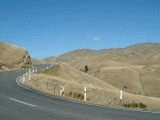
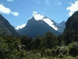 Milford Sound can be reached through a pass, which offers as usual a nice photo opportunity.
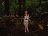
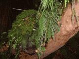
 When over the pass we stopped in a forest with many kea’s. This is the national bird of NZ, a kind of parrot. They were there indeed, but too far to show good on a picture. In stead of that we took a picture of a fern tree in a dark forest, with some sunrays protruding the leaves
 We stopped with the camper to enjoy the lookout after the pass. The valley is churned out by an ancient glacier
 Everywhere you see red tussock, a kind of grass
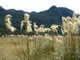 But it can be nicer: here a field of white pampas grass swinging in the wind.
 What you see here is the jungle in the background which stops abrupt. It was cleared for the sheep. The moderate climate jungle with its complex life forms, is lost forever. For a few sheep!! A tragedy.
 On the horizon we see an interesting phenomena near Tuatapere: A forest fire has smoke which merges in the the cloud it generates.
 In Invercargill we visit the interesting museum.
We see the very interesting tuatara. A weird animal about half ammeter long, dating from 350 million years ago, older than the dinosaurs! Somehow it is not extinct, a few animals live still on a island in front of the north coast. It can be very active until 6 degrees and the heartbeat can be as slow as one per minute. The look a little like a lizard but are total different. They can become very old, this one is 120 years, and probably will live for a long time.
 Here is Lands end bluff, the south point of New Zealand, Next is the south pole, 4812 km away. The excursion to the aluminum smelter there unfortunately is cancelled.
We planned to drive to the north along the ast, the Catlins. Very scenic.
Here is Lands end bluff, the south point of New Zealand, Next is the south pole, 4812 km away. The excursion to the aluminum smelter there unfortunately is cancelled.
We planned to drive to the north along the ast, the Catlins. Very scenic.
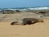 At the coast we sea a big sea lion near Waipapa. They rest there, in the sand, quietly but very alert. We are here some 5 meters from the big sea lion. Never be between the see and a male sea lion. They attack then. You may not survive this.
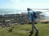 Despite the sun a gale is blowing here. Birgitt “flies” in the wind.
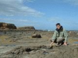 Near Curio bay we inspect a 180 million years old petrified forest. The sea slowly erodes away the soil, exposing the fossils.
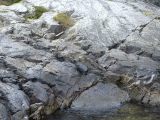
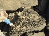 Strange rocks probably with fossils can be seen everywhere.
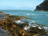 Elephant kelp slowly moves in the waves. The leaves are like thick leather and the kelp survives the smashing on the rocks over and over again.
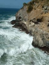
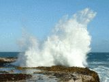 The waves explode against the coastal rocks, sending huge masses of water in the air with a thundering noise.
 We spend the night on a primitive camping at the coast. We a lucky, we see Hector dolphins paying in front of the coast. The camper stand between a long leaved plant called flax here, total different from the European flax.
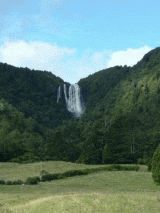
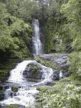 We make a detour to the Mc Leavis Falls. It is a nice half hour walk. The jungle around it has nice trees, covered with mosses and other plants The many birds sing their song. The trees are the indigenous podocarp trees. Exclusive for New Zealand and similar like the forests 200 million years ago.
 From the High Cliff Road we have a nice view over the sea. On these giant cliffs we see lots of sea lions. They are difficult to see as the distance is considerable and they are nicely camouflaged.
 Dunedin is a nice town , sheltered by a peninsula. At he end of the peninsula is a Royal albatross colony. On de way to it we pass nice scenery.
 Close near the albatross colony are great waves, The albatrosses leave the colony to fly around the world. They come back to the same location where they have been born. A pair split up for their lonely flights all around the southern hemisphere, but they return within minutes from each other.
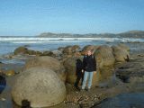 Further to the north we visit the famous Moeraki Boulders. These are formed in a mysterious natural process. The boulders are washes from the layer bordering the beach, containing all sizes of boulders. If they fall apart you see a network of calcite
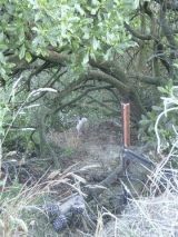 Penguins are not only living on Antarctica but sometimes you can see them in New Zealand as well. Not all the species are abundant. The yellow eye penguin is very rare and only sometimes visible in the south. We made a detour and a walk to visit the place were the sometimes hide. We were very lucky! Here is the most northerly yellow eyed penguin in the world. The chick was late and still not ready for open sea operations. However, it managed to climb thirty meters above sea level on the rocks, between the shrubs. You can see the chick in the center of the picture, left of the red pole. We were exited to see such a rare bird.
 We decided to turn inland again and there seems to be rare fossils and minerals. We stopped at a small and expensive museum, operated by retired British mine engineer. He had many interesting fossils and minerals on display and kept talking about his hobby. He had a surprise, at about 15 kms from here there was very recently a whale fossil discovered. He gave us a map and we tried to struggle on dirt roads to fin the fossil. And we found it! Amazing. The yaw was good visible. We decided to give the area a closer look and …….
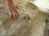 SURPRISE!!!!!! We found in a rock nearby the ribs, probably the smaller lower ribs of the whale (or another whale).
 Near Lake Matheson we saw the highest mountain of new Zealand, the Mount Cook from the west. Now we wanted to see the mountain from the east so we drove inland. The weather was fine and the landscape beautiful Here we pass along extended fields of read tussock, a kind of grass, basking in the sun.
 It was the end of the day when we arrived in the area around the Mount Cook. The mountain was partly shrouded in clouds and offered nice picture. On the side the Tasman Glacier is visible. It is difficult to imagine that the valley in front of us was 20.000 years ago filled with 1000 meter thick crust of ice.
 We spend the night in the valley at the foot of the mountain and could study the enormous forces which created the valleys. Earlier we have seen lakes which were created by gigantic volcanic eruptions and explosions, here an other mechanism creates lakes. The enormous glaciers not only cut out the valleys but further churned out the enormous lakes. When the glaciers disappeared the lakes remained, filled with water. The erosion of the mountains continued and very slowly the beginning of the lakes were filled up by debris, stones, silt sand and other erosion products. Here is nicely to see that the lake is slowly filled up so a low flat plain is existing now in the area where once a glacier lake was. Over million years the mountains will erode and the lake further filled up.
 On this picture is clearly visible that the process of erosion and filling up the lake continues. The glaciers are moving and the debris under the ice are moves slowly under enormous pressure. The movement and pressure grind the stones slowly, but continuously and the melt water transports the resulting “rock flour” down. The lake is colored by the rock flour to a turquoise color and slightly milky. If you see a turquoise milky river or lake you can be sure it is fed from a glacier.
It was time to catch the plane to Australia, from Christchurch, the capital of the South Island. We made an interesting detour through the center of the island and moved slowly to Christchurch. A well organized, town with friendly people. We spend the time prior the delivery of the camper in Christchurch and enjoyed the fast internet connection in the post office in the center of town. We delivered the car without a scratch and as I had plenty of time I decided to drop Birgitt at the airport to guard the luggage and, with my running gear on, then run back from the camper drop off point to the airfield. The manager however insisted to bring me to the airfield, so we had ample time to spend our last NZ$ in the tax free shop. The flight to Australia was uneventful.
 We landed in Melbourne, and the usual problems about seeds and shells we collected elsewhere. When this was solved we took a taxi with a not motivated Greek driver to the hotel. Next morning a taxi to the Kea Camper company to collect the camper. It was a nice, new Toyota even with hot and cold water. First again the town center to see if Nokia was able to fix the communicator, which failed on Fiji. In the Communicator the complete text of the website was already typed in, but inaccessible. I was so unmotivated to start all over again that it did last so long to get this site on the web.
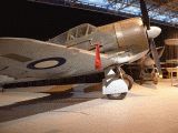
When leaving Melbourne to the west, we noted the Australian Air Force Museum in the maps. We visited it, and it was not only free, but interesting as well. There were indigenous Australian designed fighters, like this CA-12 Boomerang, and training planes. Impressive was a Douglas A-20C Boston. Once the Royal Australian Air Force (RAAF) counted 6000 planes! It was a great experience. We got a special tour by a retired air force officer, who gave us the .tip to visit a hanger of a former airfield, where enthusiasts are rebuilding a B-24
Later we went to that reconstruction site of a B-24 Liberator. The remains of this huge
Four engine bomber were rebuilt to almost flying condition.
 One of our long standing plans was to follow the Great Ocean Road. It has stunning views, and it’s very attractive to drive along the coast. It is not typical Australian as this area is often hit by cold stormy weather from Antarctica.
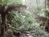
First we visit the Erskine falls, 88m high. More impressive however was the lush moderate climate rainforest in this area. Tree ferns were just like in New Zealand. However everywhere the smell of gum trees, a kind of eucalyptus. Many lorikeets, like parrots, were flying around. Here they were white with a yellow crest, gray with rose, and a red body with blue wings. Magnificent birds.
One of our long standing plans was to follow the Great Ocean Road. It has stunning views, and it’s very attractive to drive along the coast. It is not typical Australian as this area is often hit by cold stormy weather from Antarctica.
First we visit the Erskine falls, 88m high. More impressive however was the lush moderate climate rainforest in this area. Tree ferns were just like in New Zealand. However everywhere the smell of gum trees, a kind of eucalyptus. Many lorikeets, like parrots, were flying around. Here they were white with a yellow crest, gray with rose, and a red body with blue wings. Magnificent birds.
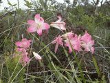 At many place pink flowers came out of the ground. No leaves, just a stem with beautiful flowers. Later we saw them everywhere.
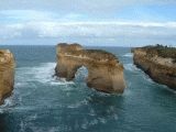 Next day we arrive at last at the 12 Apostles. These are rocks which are eroded by the sea and standing as massive pillars off the coast. They have fancy names like Loch Ard Gorge blowhole, The Arch, London Bridge or Grotto.
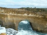 Often they first form a natural bridge and when the bridge collapses, the pillar stays on its own. Slowly it will be eroded by the elements.
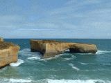 This is a special one. Ten years before on span of this multiple span bridge collapsed while tourists were on the tip. They survived and had to be evacuated by helicopter.
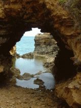 The 12 Apostles are very photogenic. You keep taking pictures and this is only a selection of the many nice pictures we took.
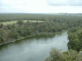 We left the coast for the north and soon arrived in an area with volcanic activity.
The Mount Eccles NP has the most recent volcano in Australia which erupted 20.000 years ago. Here we look from the top of the volcano in the crater lake.
We left the coast for the north and soon arrived in an area with volcanic activity.
The Mount Eccles NP has the most recent volcano in Australia which erupted 20.000 years ago. Here we look from the top of the volcano in the crater lake.
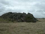 We discover an area with basalt domes. Pushed out of the ground by volcanic forces.
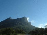 We travel to the north to the Grampians. A mountainous area in the further flat land. The rocky shelf is slant so one side of the mountains is almost vertical, the other a more gently slope. Here we see our first kangaroo. Often we see grass palms, in the east called “black boys” as they are often black scorched by the frequent fires. The Grampians are special as it is an isolated ridge in a semi-arid area. Many species can only live here and not “escape” from the Grampians.
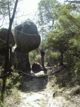 We like to climb in the mountains. One boulder was about to fall, so I had to keep it in place so Birgitt could pass safely.
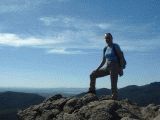 On the way to the top Birgitt stops to enjoy the scenery.
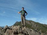 We take a detour to the McKeys Peak It is a strenuous climb, rather risky by the steep rocks. But we manage to make it to the top. Soaked of sweat we take a break, while we further study the rest of the trek.
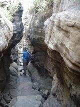 On the way down we follow a narrow and deep canyon.
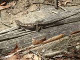 This nice lizard was basking in the sun on a log.
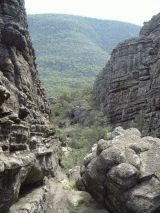 The canyon becomes wider and offers a nice view.
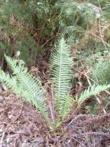 The Grampians have unique flora and fauna. Here are 2 of the 7 ferns types, that only can be found here.
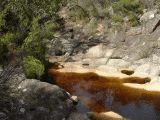 This nice area is called Venus Bath. The brown color is caused by the decaying leaves and twigs.
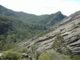 Here is nice to see the giant slant slab which is tilted some 40 degrees.
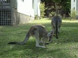 Back in the RV camp after an eight hour walk we see kangaroos, well adapted to the life in town.
 Lots of birds here. The most spectacular was the laughing kookaburra, a bird with a big bill, making a laughing sound. Lots of parrot like white cockatoos as well
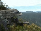 This is a famous point, the Balconies. You find this on every book or leaflet about the Grampians.
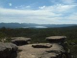 This is the nice view, near Reids Lookout. We love the light here, which makes pictures so special.
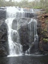 We visit the Mac Kenzie Falls. They have always water. We climb down and enjoy the cool air generated by the waterfall. We drive further to the north, and plan to spend the night at the lake of Natimuk. Interesting, there is no lake as it vanished many years ago. Probably it will be a lake again when the drought ends.
The “lake camping was empty and we met a group schoolchildren, busy with a rock climbing course on the nearby Mount Arapilis. The teacher, Nuccia Turley helped us out and invited us to see the rock climbing and so we did the next day. But first we visited the “lake”.
In Australia there are areas that are green and slowly are drying out until they are almost desert. The cycle is twenty years, then it’s lush green again. We did not hear an explanation for this strange phenomena.
We enjoyed the dry lakebed on our daily 40 minutes run, but this time it took longer. We could study the pioneer vegetation which develops in this dry lake. Very interesting.
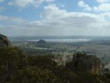 From the dry lake, we saw at the horizon the Mount Arapilis, 369 m high. It is a gigantic chunk granite, salmon pink / orange, that rises vertical out of the surrounding landscape. From the mountain we see the Mitre Peak and in distance a white lake. It’s a salt lake. Over million years the south westerly wind have carries just a little salt from the ocean. But as there is no exit to the sea the salt has accumulated and in dry period the lake is a salt flat.
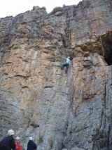 The guys and girls were climbing up and down under supervision of their lovely teacher, Nuccia Turley . It must be real challenging if you do it for the first time.
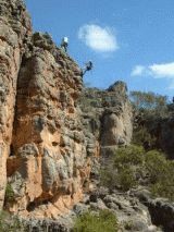 Around the corner another group was training. The Mount Arapilis is considered the Rock Climbing capital of the world.
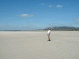 Here we are on the salt lake, mentioned earlier, the Mitre Lake. We have to trespass, climb fences to come on the lake. You can find here a salt plant, in Dutch called “zeekraal”. It’s indeed tasting spicy and salty. The Mount Arapiles this time is on the horizon.
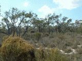 We drive north through Little Desert, with very remarkable mallee vegetation.
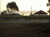 We stop in Nhill, were the camping is crowded with cockatoos with a pink stripe on the breast. Everywhere we meet nice people, here we spend an evening with Sandy and Peter, who know all about birds
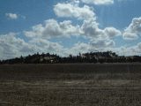 We spend a day in the Big Desert and enjoy the desolated area, though with interesting flora and fauna. It is a big area. First we pass it to the east then enter it.
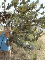 Just north of Rainbow we see a interesting shrub. It is clearly a eucalyptus with huge seed boxes .
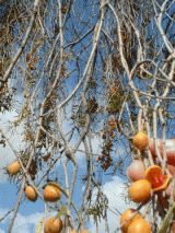 On the way from Yapeet to Nypo we see a strange tree, the weeping Pitosporum (pytosporum phyllyreoides) with orange berries. In it are red, shiny berries. The Aboriginals collect and dry them and process them in a kind of flour.
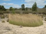 We make a long walk in the hot Big Desert. Abundant here is the porky pine grass. The leaves are needle sharp and virtually impossible to penetrate without being severely hurt. It grows very slowly, dying in the center. So it forms a ring and in the center is a refuge for all kind of animals, who are safe there.
 We take out time to study the strange plants and animals able to survive here.
Interesting is the Invisible plant (popolepis capillaris). It has white flowers and a very thin, extremely hard stem. Like iron wire. In the middle insects, under the surface making a trap for others.
We take out time to study the strange plants and animals able to survive here.
Interesting is the Invisible plant (popolepis capillaris). It has white flowers and a very thin, extremely hard stem. Like iron wire. In the middle insects, under the surface making a trap for others.
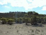 During the walk we enjoy the sight of the sturdy mallee vegetation. In this area there are lots of flies. They are small, a little slow but aggressive and persistent. And the people are very friendly in this part of Australia. They wave when they see you, at least it looks so. However they often just chase away flies. This is called the Australian salute.
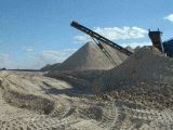 We pass an area with lots of gypsum. We see a mine and just enter. We go to the chief there. He explains that the gypsum has a purity of more than 90%, the highest quality in Australia. Especially suitable for high quality purposes. The gypsum forms here often clear, big crystals. The owner gives us a tour around the facilities and gives us nice gypsum crystals and two caps against the sun. Thank you!
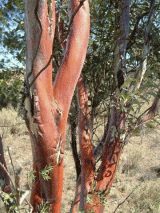 In the mallee you can find a kind of eucalyptus which have a bright bronze color, like metal. It sheds its bark, and a new bronze colored layer forms.
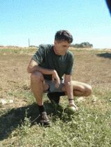 At the roadside we often find a kind of pumpkins. They look like small watermelons, but taste like bitter cucumbers. Of course we collect the seed to grow them in our garden.
In this large area there is the infamous 20 year weather cycle. The cycle starts with lots of rain, the lakes are filling, the country is lush green and the agriculture is very successful. Then the rain slowly stops and the area dries out. In this period often all-destroying fires occur. The agriculture stops. Now we are 6 years in the cycle and another 14 years of drought can be expected.
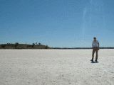 We visit the Pink Lakes in the Murray-Sunset national Park. Every salt lake has its own story how it was formed. The previous were formed by the salt crystals blown from the sea for millions of years. These accumulated in the dry area in salt lakes. The pink lakes are quite different. Many million years ago here was a big shallow lake fed by the sea. As the area slowly submerged, new seawater flooded in. The salt crystallized over the years in enormous quantities, forming under earth domes. In these days the domes are slowly dissolved by ground water and on the surface the salt appears. In springtime these areas are lakes, after the hot summer the lakes turn pink by micro organisms and eventually become salt layers. The salt of Lake Hardy has crystals that looks like a million diamonds.
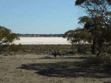 In this rather barren country still lots of animals like the kangaroo’s in the middle of the picture, can survive. Lake Grozier in the background.
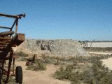 The salt was mined for many years from Lake Becking and other lakes, and every season the salt was replaced by nature in the form of a new layer. It was done in the summer and very hard work. Some ten years ago the salt mining was suddenly halted and the machinery was left in place, rusty. The heaps of salt stayed in place and are now light gray hills, hard as concrete.
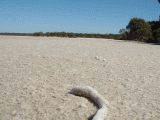 There are a few pink lakes, in this time of the year with a shining salt crust. On the foreground a tree branch, covered with salt like diamonds.
 Here we pass a monument of Australian paranoia, the Fruit Fly zone. Some states are protecting their production by not allowing anything to pass their borders. The excuse is the fruit fly. According the Australian experts, the fruit fly seem to stop just at the political border, the flies apparently can read the no-fruit fly signs. On just a road, on the straight-lined border of South Australia, no fruit or vegetables is allowed to pass. Or you have to cook it! So we did with potatoes, as by principle we did not like to throw anything away. We cooked apple sauce from the apples, ate 5 oranges. As we were full, we had to hand over 2 tomatoes. Not declaring the fruits and vegetables will result in a hefty fine on the spot. On other roads you can just pass.
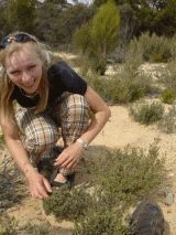 We drive to the south along the west side of the Big desert. Very interesting plants can survive here. This one has tiny fruits
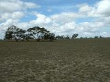 More to the south we see a typical, but sad landscape. The very interesting Big Desert vegetation here is cut and transformed in a very poor pasture. Only a few animals can survive here on a enormous terrain. The Australians traded the interesting biotope of the desert for some cattle, which has problems to survive. It does not seem profitable. A farmer told us indeed that, to survive, ever bigger farms are required. More than 90 % of this area is destroyed. If this was their intention, the Australians are very successful. Congratulations!
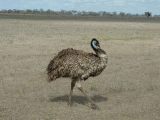 Until now we were not very lucky in spotting the emu. Nice very big birds. Speckled brown, with a blue head. Here is the first we could see from a close distance.
 Traveling to the south we head for the Naracoorte, to visit the caves. Our expectations are not too high. We did visit the Carlsbad Caverns in New Mexico and then you are spoiled forever.
The Naracoort caverns however offer special things, like the remains of extinct animals. Not old enough to classify hem as fossils (some 50.000 years old). In the evening we visited the bat cave. In the dark thousands and thousand of bats leave the cave. On the picture you can see a few.
Traveling to the south we head for the Naracoorte, to visit the caves. Our expectations are not too high. We did visit the Carlsbad Caverns in New Mexico and then you are spoiled forever.
The Naracoort caverns however offer special things, like the remains of extinct animals. Not old enough to classify hem as fossils (some 50.000 years old). In the evening we visited the bat cave. In the dark thousands and thousand of bats leave the cave. On the picture you can see a few.
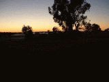 Next day we decided to visit the Victoria Fossil Cave. As we like to do our daily run first we get up in the dark and see a nice sunrise, with misty clouds at eye level. Then we prepare the camper for departure. The end of the trip is coming close and we slowly have to decide which treasures we take home and which to discard. We had a lump of crystalline gypsum, rather heavy but beautiful. Still we decide to discard it. Well, first a picture of the transparent gypsum, the we leave it at a visible place so some else can enjoy the nice crystal.
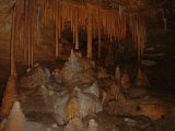 We had booked the tour and our tour guide was Christina, very knowledgeable and enthusiastic. For us the most interesting was the skeleton of Thylacoleo, the marsupial lion. But the skeletons were not only interesting, the many stalagmites and stalactites as well. Christina made the tour very special.
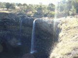 On our way back to Melbourne we select some interesting sites to visit. One of them is between Colderaine and Hamilton, the Wannon Falls. A lava bed is slowly worn out by a little stream. This must be the result of many, many years.
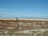 Lake Corangamite is big, but as most lakes now dried to a salt lake. Remakable is that in the mud salt plants can survive. They taste juicy and salty. Nice to chew on.
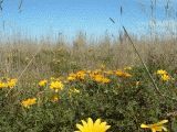 The ganzania’s on the border of the lake have a wide spectrum of beautiful colors. We travel further and see an internet facility in a fire brigade museum. The museum is what you can expect: a collection of rubbish, but the lady who volunteers there has interesting stories about the hard country life. The youth leaves the villages in the rural area’s as soon as they can to the towns. The farms have to be bigger and bigger just to survive. They have real problems with the agricultural subsidies of the European Union. This destroys traditional markets. They are worried about the future.
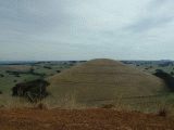 We visit Mount Leura near Camperdown. It was long ago a volcanic area. 10,000 till 30,000 years ago huge streams of lava came in contact with underground water. Huge explosions followed and enormous fountains of ash dust erupted. A porous red material was formed into ash cones. The explosion formed gigantic lakes, which still exist. The volcanic ashes eroded into fertile ground.
We went on to Melbourne, to pick up our Nokia, but they couldn’t repair it and left us with a bill of 50 dollar, and a non-functioning Communicator. The main reason for the long time before this website was ready.
 We were more and more worried about our planned next destination: Singapore/Malaysia. The mysterious SARS disease was spreading like wildfire, and the American invasion in Iraq was going on. Malaysia, as an Islam country would not be too safe for western people, we expected. In Melbourne we could re-book our tickets to fly after an hour stop in Singapore directly to Amsterdam. We took off at 16.30 in Melbourne and next morning we saw the sun rising over Rumania. After a 14 hours flight we landed next morning at 06.00 at Schiphol, after 9 weeks happy to see Holland again. Only a few days we allowed ourselves to visit friends and family, and to pack for our summer holiday in Hungary.